


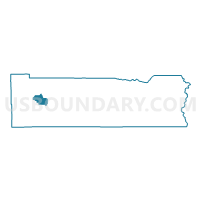
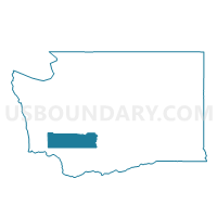
Crego Voting District, Lewis County, Washington
About
Outline

Summary
| Unique Area Identifier | 687488 |
| Name | Crego Voting District |
| County | Lewis County |
| State | Washington |
| Area (square miles) | 24.25 |
| Land Area (square miles) | 24.21 |
| Water Area (square miles) | 0.03 |
| % of Land Area | 99.86 |
| % of Water Area | 0.14 |
| Latitude of the Internal Point | 46.59996490 |
| Longtitude of the Internal Point | -123.01987260 |
Maps

Graphs
Select a template below for downloading or customizing gragh for Crego Voting District, Lewis County, Washington


Neighbors
Neighoring Voting District (by Name) Neighboring Voting District on the Map
- Adna Voting District, Lewis County, WA
- Boistfort Voting District, Lewis County, WA
- Claquato Voting District, Lewis County, WA
- Curtis Voting District, Lewis County, WA
- Emery Voting District, Lewis County, WA
- Evaline Voting District, Lewis County, WA
- Meskill Voting District, Lewis County, WA
- Newaukum Voting District, Lewis County, WA
- Veness Voting District, Lewis County, WA
Top 10 Neighboring County Subdivision (by Population) Neighboring County Subdivision on the Map
- Winlock-Pe Ell CCD, Lewis County, WA (7,092)
- Napavine CCD, Lewis County, WA (5,571)
- Bunker CCD, Lewis County, WA (3,379)
- Newaukum Prairie CCD, Lewis County, WA (2,608)
Top 10 Neighboring Unified School District (by Population) Neighboring Unified School District on the Map
- Chehalis School District, WA (14,527)
- Winlock School District, WA (4,446)
- Napavine School District, WA (4,316)
- Adna School District, WA (3,736)
- Boistfort School District, WA (894)
- Evaline School District, WA (823)
Top 10 Neighboring State Legislative District Lower Chamber (by Population) Neighboring State Legislative District Lower Chamber on the Map
Top 10 Neighboring State Legislative District Upper Chamber (by Population) Neighboring State Legislative District Upper Chamber on the Map
Top 10 Neighboring 111th Congressional District (by Population) Neighboring 111th Congressional District on the Map
Top 10 Neighboring Census Tract (by Population) Neighboring Census Tract on the Map
- Census Tract 9715, Lewis County, WA (7,092)
- Census Tract 9713, Lewis County, WA (5,571)
- Census Tract 9701, Lewis County, WA (3,379)
- Census Tract 9714, Lewis County, WA (2,608)